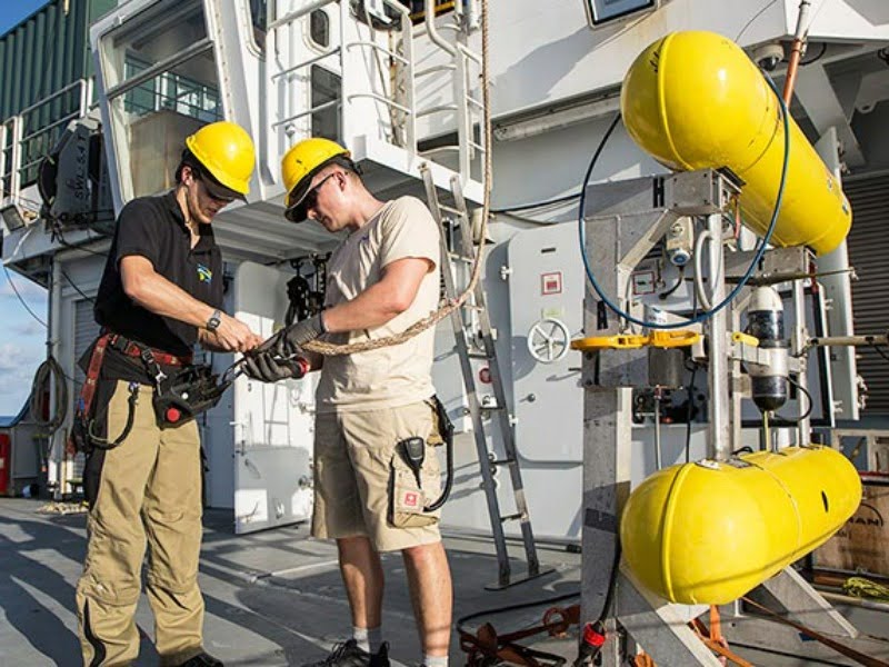
While Australians were celebrating the arrival of 2021, off the coast of eastern Australia the Schmidt Ocean Institute’s research vessel Falkor was busy mapping the seabed with a drone for a hugely ambitious global project, Seabed 2030, to produce a definitive map of the world’s ocean floor by 2030.
Schmidt Ocean Institute executive director Dr Jyotika Virmani will speak on how drones are revolutionising underwater research at the World of Drones & Robotics Congress 2021, to be held at the Brisbane Convention & Exhibition Centre on 18 and 19 August, supported by InnovationAus.
She will also discuss Falkor’s discoveries on its survey voyages in Australian waters in late 2019 and early 2020, including the discovery of a new coral reef off Western Australia.
For its research in Australian waters Falkor use a tethered remotely controlled underwater vehicle. These have been around for many years (the first was built in 1953), but it is the development of autonomous surface and subsurface drones, which the institute is trialling that is making Seabed 2030 achievable, Dr Virmani said.

“The robotics technology of submersible drones has changed quite a lot in the last five years or so. What we are seeing now is unmanned surface vessels, controlled by somebody on land, that have the ability to deploy and recover autonomous subsurface drones.
“At the end of 2015, about five percent of the sea floor had been mapped. And the estimate was it would take 200 to 600 years to map the entire sea floor at the rate we were going with the technology of the day. And back in 2015, the estimated cost to map the sea floor to high resolution was slightly higher than $3 billion. With these technologies, we can do it much cheaper.”
Before joining the Schmidt Ocean Institute Dr Virmani was a senior director with the XPrize Foundation: a non-profit organisation that designs and hosts public competitions to encourage technological development to benefit humanity. She was prize lead for the Ocean XPrize that, in 2019 awarded a US$4m XPrize to GEBCO-NF Alumni, an international team based in the US, for its development of an unmanned surface vessel, the SEA-KIT, for use on the Seabed 2030 project.
“SEA-KIT did a three-week mapping mission in the Atlantic without anybody on board,” Dr Virmani said.
“The big breakthrough through that XPrize competition was twofold. Until then very few autonomous subsurface vessels had actually launched from the coastline; it was very difficult to do that. The second thing was the ability for a surface vessel with nobody on board to launch an autonomous vehicle at sea and recover it.”
She said another aspect of SEA-KIT that supported Seabed 2030 was the use of cloud technology to process data from the subsea drones in near real-time. This provides results from survey data that enable decisions to be taken to modify the survey while it is underway.
Another successful autonomous vessel, also backed by Schmidt Ocean Institute founders Eric and Wendy Schmidt, is Saildrone. It claims to be “the world’s leading collector of ocean related in situ data via uncrewed vehicle, above and below the sea surface.”
“Saildrone went around Antarctica in the winter where it’s too rough for people to go. That’s another advantage of these autonomous vessels,” Dr Virmani said.
“It measured carbon dioxide. Until then, scientists thought Co2 was absorbed by the ocean in the winter around Antarctica. Turns out it’s the other way around. The ocean outgases Co2. Until then, it had been too rough to go and take those measurements.”
The Schmidt Ocean Institute is also planning to make greater use of underwater drones. It has just acquired a new survey vessel, the Falkor (too). “Our goal is to have that as the mothership, and a bunch of autonomous drones we can deploy from there,” Dr Virmani said.
And underwater exploration using drones is not only for well-funded global research organisations. A tethered unit with a 4K camera capable of operating at depths up to 100m can be bought for $2000 in Australia.
Dr Virmani said: “Those are being used to photograph the underside of manta rays, and there’s a massive database where you can identify manta rays from those photos. So they open up an opportunity for citizen scientists to feed the data into the scientific research, for fun and for educational purposes.”
This story was produced as part of a media partnership between InnovationAus and World of Drones and Robotics Congress to be held in Brisbane Convention and Exhibition Centre on the 18-19th of August.
Do you know more? Contact James Riley via Email.
